From Source to Sea: Our Thames Path Walk
By Brendon Mackenzie
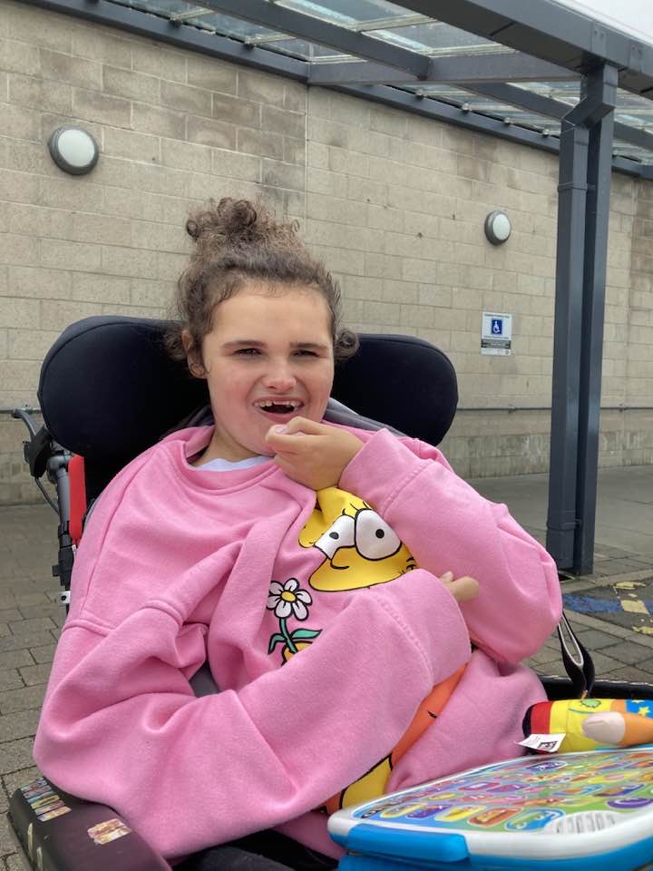
I’ve been raising money for Reverse Rett for a few years, after meeting a young girl, called Shona with Rett syndrome who was a bridesmaid at a friend’s wedding. After looking into the disorder, the work that Reverse Rett do, and hearing the testimonies from the parents they help, I couldn’t think of a more deserving cause. Working in the Pharmaceutical industry I’m acutely aware of the difficulty of raising funds for research into rare disorders where there is no potential profit for the private sector, so this is my way of giving something back.
I’ve done several charity walks since Covid, and started raising money for Reverse Rett with a walk along The Ridgeway, 87 miles from Avebury in Wiltshire to Ivinghoe Beacon in Buckinghamshire, in 2021 after the winter lockdown. Last year it was 150 miles from my home near Newbury, along the Kennet and Avon canal, Wessex Ridgeway, South Dorset Ridgeway, and coastal path to Lyme Regis. Having a job and young family I find doing the walks in sections, a day or two in length, is the best way to attack such a challenge and means I can spread the fund raising out for longer and raise even more money. It also means I keep the wife happy by not being away for long periods at a time. It does have its own challenges, mainly logistical, organising travel to and from the end of each section, and dodging bad weather, making decisions at the last minute etc, which can be difficult.
The walks themselves are often challenging too, especially for someone that’s unfit, overweight and with creaking knees/ankles/hips like me, but I’ve found them incredibly rewarding. There’s something amazing about walking alone in nature, in the beautiful British countryside, away from the hustle and bustle of everyday life, with nothing but the sound of the birds, the wind and your own footsteps, watching the seasons change around you, with only your own thoughts for company. There’s something very zen about it. I can walk for hours, just putting one foot in front of the other as the miles go by, with barely a thought or worry in my head, and that’s something we can’t say very often in the modern world. I have my phone for navigation and emergencies, but I don’t listen to music, look at emails or scroll through twitter, it’s just me, and the landscape. It’s good for the soul.
As spring was approached this year, I began to get itchy feet as usual, and started thinking about the next challenge. It needed to be something longer than previous walks, somewhere relatively local, with good transport links and preferably with no hills, as the final Jurassic coast section of last year’s walk nearly killed me. I read somewhere that the Thames path had recently been extended from its old end point at the Thames Barrier in Woolwich all the way to the coast at the Isle of Grain in Kent. At 238 miles, with loads of good transport options, passing very close to where I live, and blissfully downhill all the way it ticked all the boxes… decision made.
The route starts at the Thames Head spring near Cirencester in Gloucestershire, a couple of miles from the train station at Kemble, reachable via Swindon by rail. There is some dispute about the location of the true source of the river, but The Environment Agency, the Ordnance Survey and other authorities say it’s here, so to hell with the devotees of Seven springs, 11 miles further north. The source here is dry for most of the year, with the river often only starting to flow a few miles down the valley, but the early spring this year was incredibly wet, with almost a month of solid rain through March, and I thought that starting as soon as the weather improved would ensure we got to see the spring flowing.
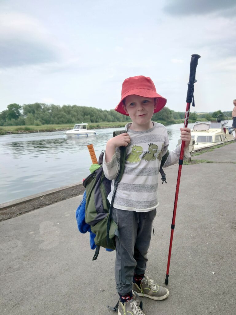
A few days out from the first weekend of April, and the forecast looked good. I packed my rucksack and dusted off the walking boots and bought some snacks ready for walking the first 23 miles over 2 days. I asked my 6-year-old son, Aden, if he wanted to come, fully expecting him to say no, but to my surprise he said yes. This was going to be a long walk for such little legs and meant I would have to take more breaks, carry more gear and the probable peace and quiet quotient had just taken a nosedive, but the boy is great company and any opportunity to spend more time with him is very welcome.
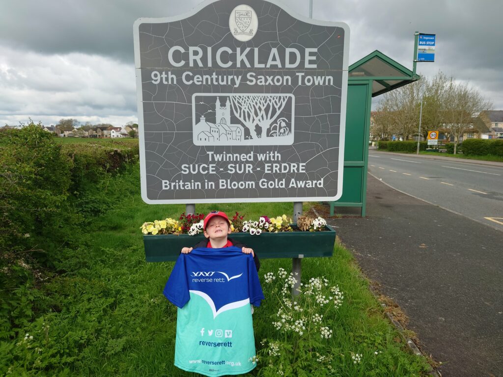
Section 1: Day 1- 2nd April – 12 (16) miles. Thames head to Cricklade
We woke at dawn, got the train and disembarked eventually at Kemble at about 9.30 am. The weather was grey, but it was dry and mild, spring had sprung, and our spirits were high.
They were dampened quite quickly as we realised that not only was the spring a few miles from the station, but the approaches to it were entirely waterlogged. An hour in and we were wading through the ankle high flooded water meadows surrounding the overflowing river, my boots weren’t waterproof, and I was starting to worry about the long and soggy day ahead of us.
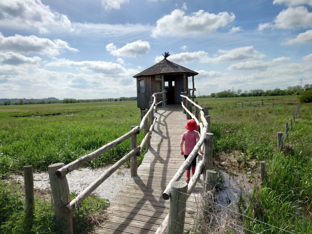
We eventually reached the source to find the river in full flow, straight from a large, flooded pool that covered the bottom of the valley, stopping us from reaching the stone marker or seeing the spring bubbling up from the ground, from where it flowed out down river, metres wide from the off. We walked along the valley, but several times during the day were forced to wade through knee deep water on the path, and often had to double back as the floodwaters got too high to navigate.
I might have carried on if on my own, but with a short 6 year old with me I wasn’t going to risk it.
The wading was slow going, and the diversions added hours and miles to an already long walk, but Aden seemed to think it was a wild adventure and his infectious laughter and constant chat kept me going.
The sun began to shine and eventually we reached Ashton Keynes, a beautiful little village with the young Thames burbling along its high-street, to the first of many pubs on this trip not serving any food when we arrived. The locals took pity and donated some leftover roast potatoes and a jug of gravy though, and a pint of crisp cold cider recharged my batteries before we headed back through the floodwaters and mud of the upper Thames valley.
It started to get late, I was limping, my knees and ankles were really painful, the boy was tiring and the five 5 miles to our accommodation in Cricklade started to feel insurmountable. A quick look on google identified a hotel a couple of miles closer, so I booked it, and after more wading, and a fresh milkshake from a farm vending machine in a cowshed, we finally made it to our room, ordered a pizza and took off our soaking shoes and socks to dry on the radiators. After a long soak in the bath we were both asleep by 9pm.
Day 2. 3.5 miles, Hotel to just past Cricklade
After a great night’s sleep and a cooked breakfast we walked the last few miles into Cricklade, but found to our dismay (and perhaps some relief) that the Thames was unpassable there, and there was no way around the floods to re-join the Thames further downstream, especially as we couldn’t guarantee that there wouldn’t be further floods all the way to Lechlade.
After a phone call to my wife to come and rescue us, we retired to a teashop for a cuppa and some Lardy cake. It would be another month before the floodwaters receded and we could attempt the next section. In hindsight, trying to walk 25 miles of the upper Thames immediately after a month of torrential rain and without working up to it, probably wasn’t my finest idea. We live and learn!
Section 2: Day 3 – May 1st. 14 miles, Cricklade to Kelmscott Manor
A month of monitoring the water levels at Cricklade on the internet later, and after prolonged dry and sunny weather we finally made it back, this time by car, leaving it parked to be collected later. The water had completely receded and very little evidence of the floods remained, just one or two pools to navigate around and a little mud to squelch through. The sun shone, the meadows were filled with wildflowers and insect life and it was great to get some miles under our belts. We snacked on malt loaf and strawberry pencils, found a pub serving pizza for lunch, and all in all had a great day. That’s not to say it wasn’t hard going, and by the end I was very relieved to see my wife who came to pick us up by the Manor house at Kelmscott, to take us back to collect my car.
In the wilds of Gloucestershire/Wiltshire on the upper Thames, transport options are very limited, so it requires either a very forgiving wife, or spending a lot on taxis. Thanks to my wife, there was a lot of the former, and not so much of the latter.
Section 3: Day 4 – May 7th. 12.5 miles Kelmscott to Newbridge
The logistical nightmare continued, and again, my wife helped out, driving with us to the end of the walk to drop off my car at a handy pub, before then taking us to the start of the walk, which was where the last walk had ended at Kelmscott Manor. It was a beautiful day, sunny, blue sky, a nice breeze and the walk was a stunner, through water meadows and nature reserves, with the spring flowers in full bloom. We saw our first kingfisher and were lucky enough to get to watch a barn owl, hungry after a few days without hunting due to rain, out in broad daylight, quartering a field looking for mice. Several of the oldest bridges on the Thames are on this section, dating back from the 13th century and still carrying heavy traffic across the river.
Section 4: Day 5 – May 21st 14 miles Newbridge to Oxford
This was the first stretch of the walk to reach “civilisation,” and the start of regular transport links on the Thames, but due to one of the local rail viaducts sinking into the river there were no trains running to Oxford and we had to drive there and then get an extortionate taxi ride to Newbridge. Another beautiful day, the flowers in the meadows and blossom in the hedgerows were incredible, young lambs gambolled around us as we crossed into sheep country and the air was filled with dragonflies and damselflies. The walk was almost ruined at the beautiful pub The Trout inn by the abbey ruins on the river at Godstow, when they refused to serve us food as we hadn’t booked, despite empty tables inside and out. I bought a pint and grumbled but managed to bypass the officious staff by ordering food to our table via the app, which we received smugly. Just past Godstow is the beautiful Port meadow on the North/West edge of Oxford, and on the opposite bank to the official path, and here we had our first paddle in the river, a godsend for my aching feet, before walking the last couple of miles into Oxford to collect the car.
Section 5: Day 6 – June 10th 15.5 miles Oxford to Clifton Hampden
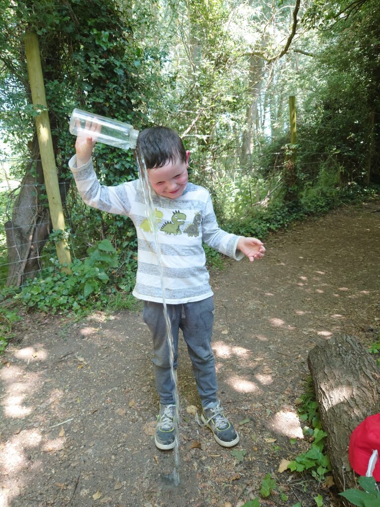
Once again the sinking railway bridge meant we couldn’t get the train to Oxford, but services were running to and from there to the end of at Culham, Near Clifton Hampden, so after an early start to avoid the worst of the heat we parked there and got the train back to Oxford station. The walk south through the outskirts of oxford in the cool morning air, and into the beautiful meadows and woodland that flank the river there was lovely, watching the early morning rowers with the city of dreaming spires in the distance. As the heat built we passed the science park where I work near Sandford, and passed through the beautiful old town of Abingdon, where we stopped at the splash park for a welcome soaking and an ice cream before continuing on. By the time we reached Clifton Hampden, it was over 30 degrees and the mile walk to the station along a busy, dusty and blisteringly hot road seemed to go on forever. The walk ended at yet another pub refusing to serve us food.
Section 6: Day 7 – June 17th 14.5 miles Clifton Hampden to Goring
Back into more familiar territory this time with the walk ending at Goring & Streatley, two towns facing each other on either bank of the river, at the point where the Thames path passes closest to my house, just a quick twenty minute hop over the Berkshire Downs in the car, where we were once again unable to get the train back to Culham, so my wife, once again, stepped up to help. The first stretch passed the wonderfully named Whittenham clumps, involved a ferry to cross the river at Benson due to a broken bridge, and then on through Wallingford, before hitting a great stretch of river between Mongewell, where we had a swim, through Moulsford, under a great Isembard Kingdom Brunel bridge, and with another pub not serving food when we passed, all the way to Streatley to collect the car. This final section was the scene of one of my previous worst walking disasters, when an error in distance estimation meant that I forced my wife to walk much further than she would choose to, and has resulted in her refusing to walk further than 10 miles ever since. She has never let me forget it.
Section 7: Day 8 – June 24th 12 miles Goring to Reading
There is something strange that happens with distance and time on these walks sometimes, and it’s amazing how so much of it is psychological. The last 2-3 miles of any walk is always a bit of a slog no matter how long the walk before it. We’ve done longer walks than this one, on hotter days, but for some reason this one was a killer. It wasn’t helped by a set of hills near the start as the path skirts around a stretch of river bank filled with rich people’s houses who for some reason don’t want to share their riverfront properties with walkers, another hill to climb as you move through Purley on Thames before a sizeable section where the path leaves the river to follow main roads, which I never enjoy, and then topped off when getting to the sign that says welcome to Reading, where this walk was to finish, about 5 miles before we reached the actual end. Those five miles stretched out for eternity, and the heat was intense. I was so happy to get to the end, and to see the paddling pool in Christchurch meadow on the north bank of the river, where we cooled down for a while as we waited for a lift home from Aden’s visiting Grandma.
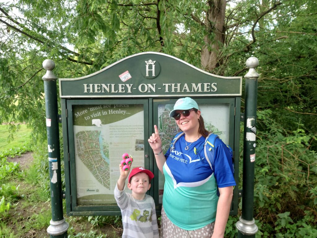
Section 8: Day 9 – July 9th 9 miles Reading to Henley
My wife joined us for this relatively short section this time, and with train services running between Reading and Henley, it felt we were finally getting somewhere, with Reading being roughly at the mid-point between the source and the Thames Barrier, the end of the old Thames path, before it was extended. As we headed towards Sonning on a lovely stretch of river, through beautiful parkland and countryside to the east of Reading that I never knew existed, and ended after a very relaxed stroll, in the beautiful town of Henley, and finally a pub that was willing to serve us some food!
Section 9: Day 10 – July 20th 10.5 miles Henley to Marlow
Day 11 – July 21st 14 miles Marlow to Windsor
Day 12 – July 22nd 2 Miles Windsor to Datchet
Heading towards the end of July, and being only halfway to the Thames Barrier, and with well over 100 miles to go to the sea, I started to worry that might not get to the end before the Autumn with loss of day light/worsening weather that brings, so we began to plan for some longer trips, over multiple days. First up was a short hop from Henley to Marlow around a big loop in the river starting on the Thursday afternoon. Again, a shorter walk turned into a terrible slog with the last few miles into Marlow along roads away from the river causing some severe joint pain, and really sapping our energy, but we made it, and my wife met us at a campsite on the outskirts of the town.
There was no one there when we arrived, the entire staff were at the pub, and there were no other campers, just us, a huge field, massive circus top,plus about 100 Portaloos and shower units. There were several Bell tents already up, so we picked one, and set up camp, feasting on army rations and biscuits before Aden went to bed and cracking open a bottle of wine as we sat in our camping chairs in the dark.
The next day we left my wife who returned home and headed down river again, past the palatial riverside properties and parkland that characterise this stretch of river, passing Clevedon house on the opposite bank and coming through Maidenhead, where yet again we managed to get some food from a riverside pub, before finally coming into Windsor in the early evening to stop at our accommodation at the travel lodge. After an hour of Aden bouncing on the beds, a quick trip outside to look at the trains, a beer at the hotel bar and a hot bath we were again asleep by 9pm.
The next day we made the silly mistake of walking another two miles to Datchet in the morning, in order to catch the train back to Henley to collect my car, but the train gods were not smiling on us, and engineering works meant a long wait for a taxi to slough was required
Section 10: Day 13 – July 29th 6 miles Datchet to Staines
A short run from Datchet to Staines in the sunshine with my wife in tow, passing through Rivermead, the site of the signing of Magna Carta, where we had a picnic on the beautiful grass carpeted riverbank.
Beyond that we finally made it inside the M25, walking beneath the bridge with the motorway thundering above us, and leaving the middle section of the Thames path behind us. It really feels like we are making progress now. Another pub serving food at the end, and another working train line to take us back to the car, all starts to make it feel like old father Thames is smiling on us.
Section 11: Day 14 – August 3rd 12 Miles Staines to Hampton Court
Day 15 – August 4th 6.5 miles Hampton to Teddington Lock
Took the train from Reading to Staines with the boy, to start another 2 day trek eastwards into greater London. We invented the game of Plum football (Kicking a fallen plum along the path, a point for keeping it on the path, a point off if you kick it into the bushes, and 5 points off if you squish the plum) which made the miles fly by as we walked through the countryside. At Weybridge we caught our second ferry of this Thames walk to the opposite bank, then onto Hampton, where we caught another ferry back across and slept the night on a tiny air B&B boat moored on an island in the middle of the river.
We woke very early to walk on to Teddington lock and the start of the tidal Thames through the lovely royal parkland along this stretch, including our fastest mile of the entire path (18 minutes!) to meet my wife who then drove us back to Hampton court where there was a day of jousting and falconry to enjoy before heading home.
Section 12: Day 16 – August 11th 7 Miles Teddington to Kew
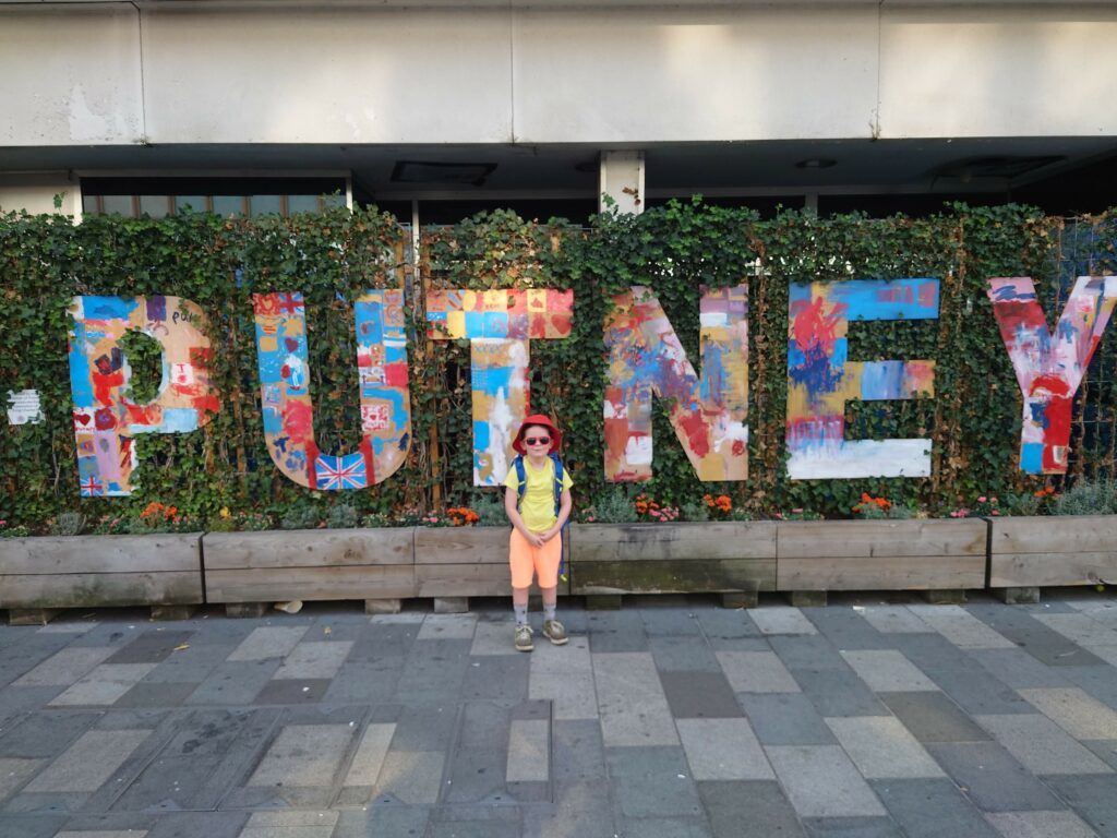
Day 17 – August 12th 6 miles Kew to Putney
Another 2 day walk, with my wife Becky coming with us this time (she was basically sick of being a hiking widow and so was forced to come with us, in order to spend any of her weekend in our company), so we had to keep the walks short, especially as she wore silly shoes and ended up with a huge blister…
This walk through the Arcadian Thames, the name for the stretch of river between Windsor and Chiswick, through miles of more royal parks, and countryside, so incredible to see so close to the centre of London, and created by the Tudors, subsequent royal families and rich landowners of the area, was incredibly beautiful. With each bend in the river you come across “a series of great palaces, grand houses, magnificent gardens and hunting parks which were constructed amid the water meadows and woodland, and linked to one another by grand avenues of trees.” That takes the name of Arcadia, an “idyllic pastoral paradise, a place where man and nature co-exist in perfect harmony. These ideas led to the formation of the English Landscape Movement and would ultimately spread across Europe.” This stretch includes the bustling hipster town of Richmond with its busy riverside pubs and restaurants, but we stayed the night at the Luxurious premiere inn at Brentford, just over the river from Kew. The next day, after walking onwards past various grand bridges to Putney, we caught the train back, to explore the royal botanic gardens and its giant Victorian glass houses full of palm trees and tropical plants. We would have spent more time and enjoyed it more, but our legs hurt, so after a quick wander, we caught the train home, through crowds of annoyingly drunk England rugby fans.
Section 13: Day 18 – September 10th 10.5 miles Putney to Tower Bridge
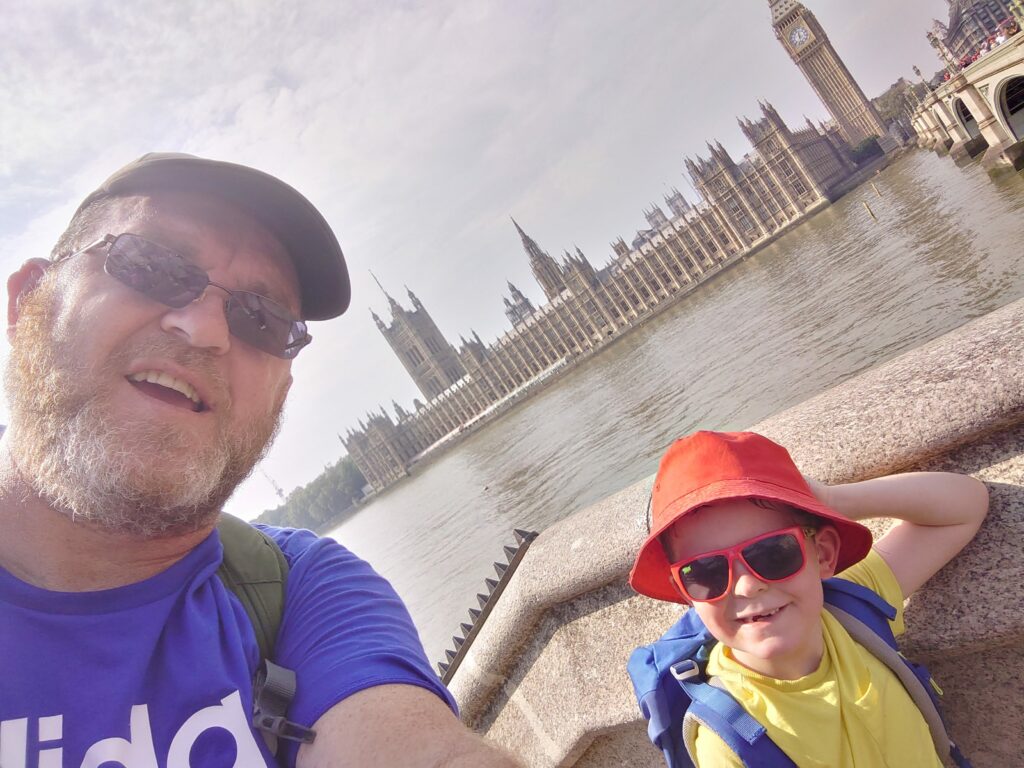
An early start and train so we were ready for the walk into central London today ahead of the summer heat. This was the stretch Aden had been most looking forward to from the start, as we got to walk right into the heart of the capital, and there was a huge amount to cram into short ten-mile walk, with a wonder around every bend. First the newly refurbished Battersea power station, surrounded by new bars and restaurants, but with an utterly soulless shopping mall inside. At least the iconic building has been rescued, I just wish they had done something that maintained the vast central hall with its high ceilings, and filled it with turbines and Victorian gizmos from the original building. We moved on, past the houses of parliament and Big Ben/the Elizabeth Tower for a quick, and wallet scorchingly expensive whizz around the London eye, with its incredible panoramic views across all of London, before heading onwards, along the South Bank, with its street performers, skateboarders, bars, restaurants and theatres, past St Pauls and the Tate Modern, before finishing at Tower bridge (which I learned was named for the Tower of London and not the two big towers on the bridge itself,) under the shadow of Britains tallest and pointiest building, The Shard, before we caught the Elizabeth line in air conditioned luxury, getting back to Reading in only 45 minutes.
Section 14 Day 19 – September 16th 12 miles Tower Bridge to Woolwich
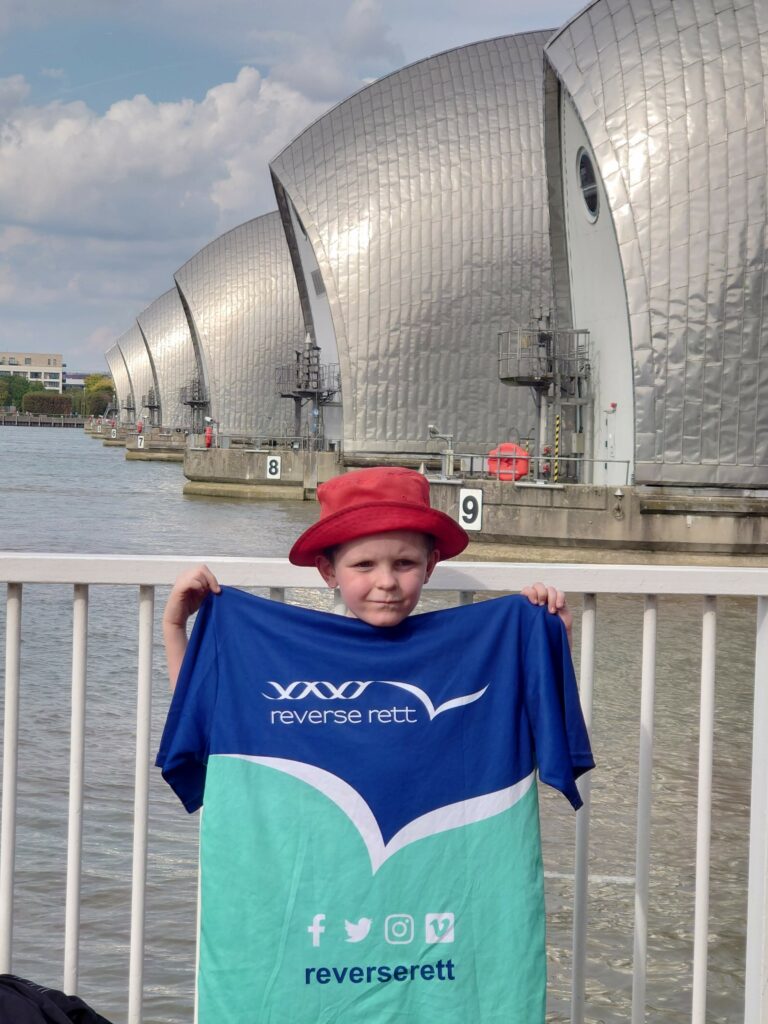
The final leg of the old Thames path today. Again, we are up at the crack of dawn to catch the Elizabeth line across London to Liverpool Street station, amongst the skyscrapers, with a short walk out to Tower bridge for one final trek across the capital to the Thames Barrier near Woolwich, past more skyscrapers at Canary wharf, the millennium dome and Greenwich.
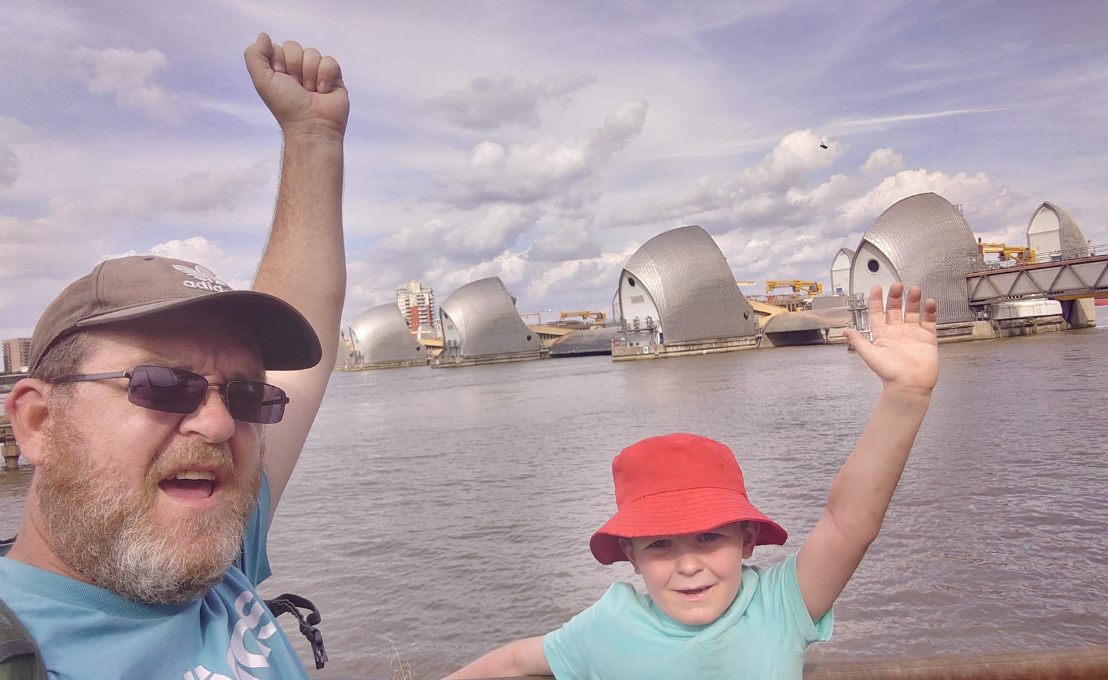
I must admit I got a little emotional when we got to the shining engineering marvel that controls the flow of water from upriver, and the tidal surges that come up the Thames Estuary during the highest of tides to stop the capital from flooding.
I’m incredibly proud of my little man for completing this walk with me, he is such a little legend. I can’t imagine there are many other six-year-olds who have walked the 180 miles of the Thames Path.
I tell him I hope that he will remember this walk forever, even when I’m dead and gone, which makes him cry and I have to desperately backpedal to convince him that this is a long way off yet.
Section 15: Day 20-22 – September 22nd-24th, 47 miles -Woolwich to Gravesend, Gravesend to Allhallows, Allhallows to Grain
One final trip, and 3 days walking to finally reach the sea. Another trip on the Elizabeth line which has been a godsend, and the less said about the first day, the better. A walk that was much too long, with much of it away from the river, walking on roads through industrial and run down dock lands, including an awful stretch where you must pass about 4 miles inland to cross the River Darent, the weather was grey and I was miserable all day. The worst section of the walk by far with no redeeming features, other that the Queen Elizabeth Bridge at the Dartford Crossing, the longest bridge on the river by some way.
It was a grim day’s trudge, but Aden kept me going and we got through it, and eventually, after about 9 hours, my saintly wife picked us up to drive to an Air B&B caravan on the Hoo Peninsula in Kent.
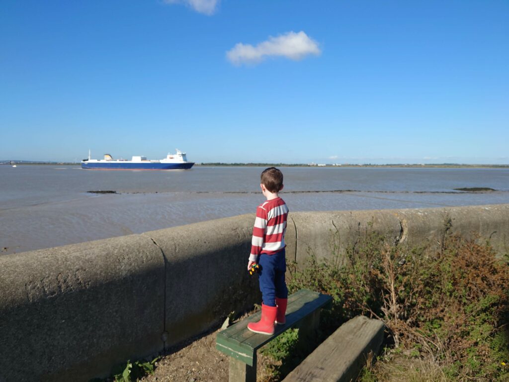
Up early again the next day for another lift back to Gravesend. The weather had cleared, the sky was blue and the walking from here onwards was brilliant. A totally different landscape, through the wilds of Kent and the divine desolation of the Thames Estuary, with its nature reserves and salt marshes, flanked by the huge, curved sea wall, with the dockyards on the opposite bank, with their huge container ships and massive cranes. A cool breeze blew away the dismal depression of the previous day and we ate up the miles in the sunshine, finally meeting my wife again at the caravan at Allhallows, where she has spent the day
The final day dawned and we set off for the short trip across the peninsula to finish at the Isle of grain. We drove to the end of the walk, with the intention of catching the bus back to Allhallows and all three of us walking back to Grain, but the bus driver had other ideas. Despite the route/schedule being published on the internet and printed on the bus shelter itself, he decided he wasn’t going to Allhallows because he was running late, so we were on our own. Bemused, we stumbled off the bus, and he drove off. If the car hadn’t been there, we would have been stranded, with the nearest taxi company about 40 miles away and refusing to drive out that far. And so my wife drove us back to Allhallows and agreed to meet us in Grain at the end. We didn’t let the vagaries of Kentish public transport get us down, and Aden and I smashed the last section out in a couple of hours, to finally reach the end of the walk, as the estuary widens out to end at the muddy beach in Grain, looking out across the grey sea towards Holland.
We had made it. 238 miles through England’s green and pleasant land, 6 months, over the Spring, Summer and into Autumn, through floods and heatwaves, from source to sea.
Aden was ecstatic as we made our fundraising target of 1000 pound on the last day.
I’ve never been so glad to finish anything in all my life. Aden wanted to walk it in the other direction from sea to source.